

- BLOG
Dispatch Mapping Software: A Complete Guide for Modern Fleet Operations
Published: September 11, 2026
Route Optimization API
Optimize routing, task allocation and dispatch
Distance Matrix API
Calculate accurate ETAs, distances and directions
Directions API
Compute routes between two locations
Navigation API & SDK
Turn by Turn Instructions for Drivers & Technicians
Route Optimization Software
Plan optimized routes with 50+ Constraints
Product Demos
See NextBillion.ai APIs & SDKs In action
AI Route Optimization
Learns from Your Fleet’s Past Performance
Platform Overview
Learn about how Nextbillion.ai's platform is designed
Road Editor App
Private Routing Preferences For Custom Routing
On-Premise Deployments
Take Full Control of Your Maps and Routing
Table of Contents
Dispatch mapping software has quietly become the backbone of how modern delivery, field service, and logistics fleets run their day. In fact, the Dispatch Software Market, valued at USD 3.62B in 2026, is projected to reach USD 4.91B by 2030, growing at a 7.9% CAGR.
Instead of a dispatcher juggling a spreadsheet in one window and a map in another, everything sits in one live view: where every vehicle is, which jobs still need assigning, and how the day’s routes should adjust the moment something changes.
Fleets running these platforms report noticeably fewer empty miles and faster response times on urgent jobs than teams still coordinating by phone.
So what actually separates dispatch mapping software from the basic routing tool your fleet might already be using? Let’s find out!
Dispatch mapping software is a platform that integrates an interactive map, dispatching of jobs, and route optimization in one screen. This ensures that the dispatcher is aware of the location of each vehicle, plans and assigns jobs based on true capacity, and modifies the plan whenever there is any change in the field.
A plain GPS tracker only reports where a vehicle happens to be. Similarly, a basic routing tool plans a route once at the start of the day and then leaves it alone. But dispatch mapping software treats the map as a live working surface. Job additions, driver reassignments, and route re-sequencing are accomplished using the same interface that the dispatcher is already using. There’s no need to export the information to another software application to achieve these results.
A lot of fleets already use some kind of mapping tool, whether that’s a consumer GPS app or a one-time route planner. But the confusion usually starts here: those tools only solve a surface-level problem. Here’s how dispatch mapping software stands out:
Capability | Basic Routing or Mapping Tool | Dispatch Mapping Software |
Route calculation | Works out one route at a time, for a single trip or a set list of stops | Keeps recalculating in real time as jobs and conditions shift |
Fleet visibility | Only shows one vehicle or route on screen at a time | Puts every active vehicle and job on a single live map |
Job assignment | Handled by hand, separate from the mapping tool itself | Built right into the map — drag it, drop it, or let it auto-assign |
Handling disruptions | Means starting the re-plan over again from scratch | Reroutes on its own around new jobs or unexpected delays |
Driver communication | Rarely built in, if it’s there at all — usually a separate app | Two-way messaging lives inside the same platform |
Not every platform has the same set of features. So here are the capabilities to check before signing up for the best one:
Every driver, every open job, and every route in progress shows up on one screen. It updates continuously, so you don’t need to refresh every few minutes. A dispatcher should be able to glance at the map and immediately see which drivers are ahead of schedule, which are running late, and which jobs still don’t have anyone assigned to them. Colour-coded status indicators are the key here. Green for on-track, amber for at-risk, red for a stop that’s about to miss its window.
It is the core feature that makes dispatch mapping software stand out from a plain map view. There is no need to rely on a complex spreadsheet to work out who’s close to the stop or who’s free at the time. Jobs get matched to drivers automatically, based on
The software checks every aspect before making a suggestion. It includes a refrigerated van for a cold-chain delivery, a technician with the right certification, a driver who hasn’t already hit their duty limit.
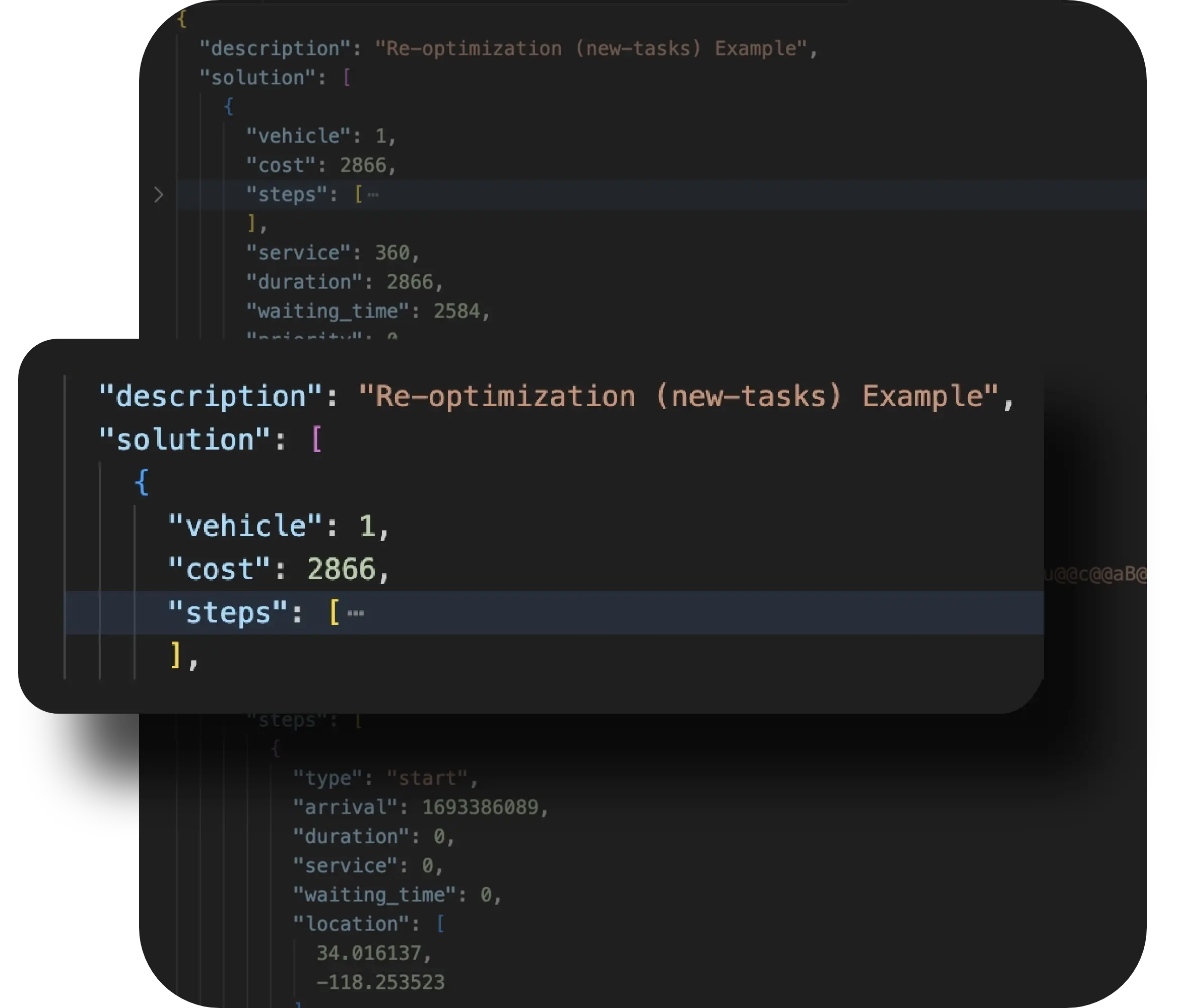
The plans always keep changing. The driver is sick; the customer shifts the appointment time; there is a backup of traffic on the only road linking half of the stops for the day. The good map software clay will assist in recalculating the routes in case of such incidents. The dispatcher need not do it himself/herself during working hours. For instance, one can be able to see the fleet that is being optimised automatically each time its route becomes disrupted.

Most platforms push route updates straight to a driver’s phone and pull job status back the other way, capturing photos, signatures, or timestamps as proof of completion. That closes a loop dispatchers used to rely on phone calls to manage, one call at a time, stop after stop. It also gives customer service a straight answer when someone calls asking where their delivery actually is, instead of a promise to call the driver and find out.
Dispatch mapping software functions with existing systems without any hassles. It usually connects to the fleet’s existing TMS, ELD, and maintenance systems. This way, the dispatcher doesn’t have to cross-reference four separate tools just to answer one question. For instance, they can verify both questions: Is this vehicle and this driver actually available for this job right now at once?
A dispatcher trying to assign an urgent job the old way ends up checking a GPS tab for vehicle location, a spreadsheet for driver hours, a maintenance log for vehicle status, and then a phone to actually reach the driver. Integrated dispatch mapping software collapses that into one screen. The assignment suggestion already accounts for location, remaining hours, and vehicle availability before the dispatcher even opens the job.

At first, the features of dispatch mapping software might sound like a long list of disconnected capabilities. But in an actual shift, they operate as one continuous loop. Here’s roughly what that sequence looks like:
↓ A new job or order enters the system
↓ It’s plotted on the live map alongside existing jobs and vehicle positions
↓ The optimization engine calculates the best vehicle and sequence for it
↓ A dispatcher reviews the suggested plan and adjusts it if needed
↓ The updated route is pushed to the driver’s mobile app
↓ GPS and status updates flow back onto the map in real time
↓ A delay, cancellation, or new job triggers automatic re-optimization
↓ The driver receives the revised plan without a phone call
Completed jobs feed into reporting and performance data
The loop is what separates this category from a one-time route planner. A route planner runs the middle steps once, at the start of the day, and stops. Dispatch mapping software keeps running that loop for as long as the fleet is on the road.
This category does not include only parcel carriers, despite the fact that last-mile delivery is what first comes to mind. Any operation that sends vehicles or technicians to multiple locations in a day, with jobs that can change after the shift starts, tends to outgrow manual dispatch at a similar point in its growth. The pattern shows up across a wider range of industries than most people expect on first hearing the term.
Emergency dispatch systems, like those used by police, fire, and ambulance services, use a related but distinct category often called computer-aided dispatch. The core idea, matching a resource to a location on a live map, is similar, but the priorities and regulatory requirements differ enough that it’s worth treating as its own category rather than folding it into commercial fleet dispatch mapping.
Most fleets choose the software to resolve specific, recurring issue which has become too expensive. It could be missed windows, wasted miles, or a dispatcher who’s become a single point of failure. Here are some common ones:
The demonstrations typically look amazing at first glance. Every provider has the ability to demonstrate how their map looks with a couple of sample routes on it. However, the problem arises when the fleet asks more questions based on how the software actually performs in practice. Make sure to ask the questions below to assess the platform:
Pricing of the software varies depending on fleet size, how much real-time optimization is involved, and how deep the integrations need to go. Here’s how to compare costs among vendors:
Pricing Model | Typical Range | What Influences It |
Per-vehicle, per month | Roughly $15 to $50 per vehicle | Core tracking, basic assignment, and a driver mobile app |
Optimization or AI routing add-on | Often priced as a separate tier | Stop volume and how often routes need to re-optimize |
Enterprise or custom plans | Quoted individually | Integration depth, API access, and support level |
Implementation and onboarding | Sometimes a one-time fee | Data migration effort and the amount of driver training needed |
Here’s a quick overview of different industries, each showing how the same core capability, a live, connected map, changes a specific daily problem.

Same-day grocery delivery runs on tight windows and unpredictable order volume. A dispatch map that shows every driver’s current load and location lets a dispatcher slot a last-minute order into the least disruptive route, instead of assigning it to whichever driver happens to be free.
Emergency service calls don’t wait for a scheduled dispatch run. A live map showing which technicians are nearby and available lets a dispatcher assign an urgent call to the closest qualified technician in seconds, rather than working through a call list by hand.

Collection routes are repetitive, but exceptions, like a blocked street or a missed pickup, still happen daily. A connected dispatch map lets a route supervisor reroute a truck around an obstruction without waiting for the driver to call in and describe the problem.
Same-day courier work often means fitting urgent jobs into routes that are already moving. A live map view of every active job and vehicle lets dispatchers insert a rush delivery into the route that adds the least extra distance, instead of dispatching a dedicated vehicle for it.
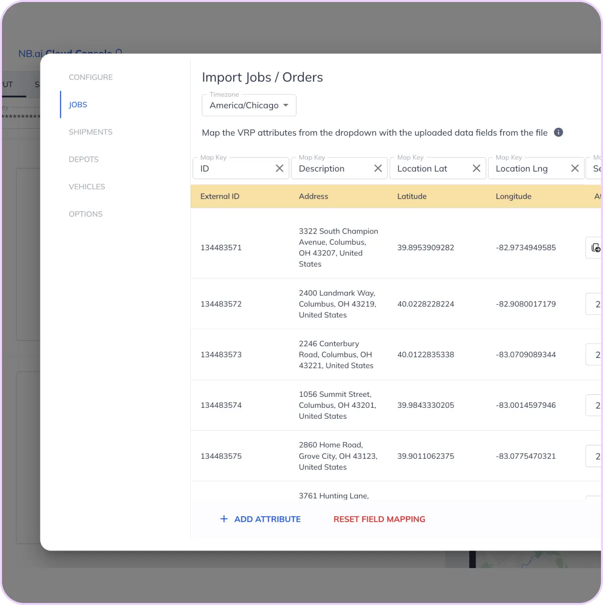
The NextBillion.ai platform is built from the mapping and routing APIs used to build the map, optimization, and re-routing. Below is how the platform is expected to work:
Instead of asking a fleet to integrate a new dispatch UI, the APIs from NextBillion.ai can be integrated into the existing platform as the layer for mapping and optimization. There is also the option of integrating a bespoke layer for mapping and optimization, which means that even though the interface is industry-specific, the logic behind it is solid.
When a new job, a delay, or a cancellation comes in, routes can be recalculated across dozens or hundreds of active vehicles in the time it takes a dispatcher to glance at the screen. There is no need for a manual re-plan or a slow batch recalculation.
The underlying routing engine is designed for exactly the kind of complexity dispatch mapping software is meant to handle: many vehicles, many stops, shifting constraints, and the need to re-solve that puzzle continuously rather than once a day.
Because the mapping and routing components are part of the same API family, the live map a dispatcher sees and the routes it calculates stay consistent with each other, rather than pulling from two different data sources that can drift out of sync.
For those who may be developing a dispatch system for a fleet or an extension to an existing system, the APIs allow you to simply plug them right into your workflow so the knowledge about how to do routing and mapping can evolve without starting from scratch.
Fleets that end up disappointed with a new dispatch platform usually aren’t disappointed with the concept. They’re disappointed because the selection or rollout process skipped a step that mattered more than it seemed to at the time.
Dispatch mapping software earns its place in a fleet’s tech stack by closing the gap between a static route plan and the messy, constantly shifting reality of an actual operating day. It brings live vehicle visibility, job assignment, and route optimization into a single, connected view, so a dispatcher can see a problem and fix it in the same glance instead of chasing it down over the phone. The platforms worth choosing are the ones where the optimization underneath the map is strong, not just the map itself. Fleets that get this right spend less time reacting to the day and more time running it.
No. GPS tracking shows where vehicles are. Dispatch mapping software adds job assignment and route optimization on top of that location data.
Usually not much beyond a GPS-enabled device or telematics unit already common in most commercial vehicles, plus a smartphone or tablet for drivers.
Yes. Many platforms scale down to a handful of vehicles, though the biggest gains tend to show up once a fleet has enough stops to make manual coordination genuinely difficult.
A TMS often covers broader freight and logistics management. But dispatch mapping software focuses specifically on live assignment, routing, and tracking.
Not really. All kinds of firms like field service providers, waste collectors, and couriers depend on the very same basic functionality, but delivery is the most commonly cited example.
It matters most where there is an urgent change in the operation process, such as emergency response and same-day deliveries. Fixed, predictable routes see less benefit from it.
In most cases, yes, since many software solutions are designed to be used on top of an existing routing or mapping API, instead of replacing it outright.
Bhavisha Bhatia is a Computer Science graduate with a passion for writing technical blogs that make complex technical concepts engaging and easy to understand. She is intrigued by the technological developments shaping the course of the world and the beautiful nature around us.