


Route Optimization API
Optimize routing, task allocation and dispatch
Distance Matrix API
Calculate accurate ETAs, distances and directions
Directions API
Compute routes between two locations
Navigation API & SDK
Turn by Turn Instructions for Drivers & Technicians
Route Optimization Software
Plan optimized routes with 50+ Constraints
Product Demos
See NextBillion.ai APIs & SDKs In action
AI Route Optimization
Learns from Your Fleet’s Past Performance
Platform Overview
Learn about how Nextbillion.ai's platform is designed
Road Editor App
Private Routing Preferences For Custom Routing
On-Premise Deployments
Take Full Control of Your Maps and Routing
About Us
Our story, vision
and mission
Contact Us
Reach out to us for any product- or media-related queries
Write to us at

Table of Contents
The locations of residences, community centers, hospitals, national society branches, and other specified points should ideally include coordinates that make mapping easier. However, in practice, many datasets save locations as plain text strings. The coordinates can be found by entering those addresses into a mapping application or search engine, but what if you need to do this on a scale
With the Google Maps Geocoding API, the addresses can be easily converted into coordinates. If a street address is legitimate and listed in the Google database, the geocoding serves as a way of determining its precise latitude and longitude. It either transforms the address into latitude, longitude, and a Place ID, or it transforms a Place ID or latitude and longitude coordinates into an address.
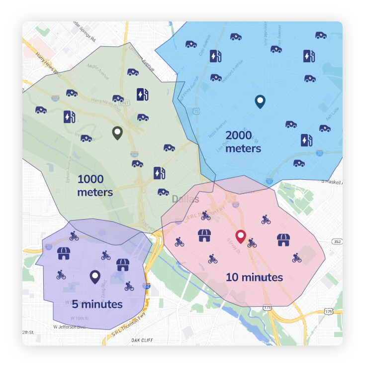
Geocoding is the process that converts addresses to coordinates API. Let’s understand how Geocoding is helpful in mapping applications, location-based services, route optimization, and enhancing search accuracy for businesses and users.
Address Geocoding API is the process of translating a human-readable address into latitude and longitude, or geographic coordinates. Many apps, especially those that use location and mapping services, depend on this functionality. The following geocoding information can be obtained for one or more addresses or locations using the Google Maps API geolocation: Addresses with geographic coordinates, Addresses for coordinate sets of latitude and longitude, and Addresses for place IDs.
You can limit the results to a specific area, county, or postal code, as well as manage where the results appear. The Geocoding API supports both forward and reverse geocoding.
Forward Geocoding API is the process that converts an address, for example “1600 Amphitheatre Parkway, Mountain View, CA,” into its associated geographic coordinates, like (37.422160. -122.084274). The map view can then be centered at that point, or markers can be placed on the map using these coordinates.
This is the process of converting geographic coordinates back into human-readable addresses. The Reverse Geocoding API enables you to obtain the closest address if you know the coordinates for a particular place, which is helpful for applications like delivery services. In this case, the (37.4221, -122.0841) will be the input, and the output would be 1600 Amphitheatre Parkway, Mountain View, CA.
Geocoding APIs make the multi-step process of translating addresses to coordinates easier. This is a simplified overview of how this conversion works:
This seamless conversion allows programs to give correct location data without any manual intervention, hence improving the overall user experience.
Precision and dependability are essential in geocoding. A unique feature of the Geocoding service in Google Maps is its seamless integration with Google Maps, ensuring access to one of the most comprehensive and up-to-date location datasets. The unique features of the API are as follows:
Google just launched Building Outlines, a much-anticipated improvement to the Geocoding API. This new feature considerably improves the “final 100 meters” difficulty that many logistics and delivery providers encounter.
Building outlines are now available through the Google Maps geolocation service, providing a more thorough understanding of the footprint of the structure. Applications that need to understand the size and layout of the structure, like emergency response planning or comprehensive mapping services, may find this particularly helpful.
With these steps, you can learn how to utilize the Geocoding API, which includes the basic setup for integrating data into your own application:

Certain parameters are mandatory, while others are optional. Parameters are separated by the ampersand (&) character, as is standard in URLs. A geocoding request must contain the following parameters:
address=24%20Sussex%20Drive%20Ottawa%20ON
As seen here, format plus codes (spaces are url-escaped to %20, plus signs are url-escaped to %2B):
components: The Geocoding API may deliver address results that are limited to a particular region in a Geocoding response. The components filter allows you to define a restriction. A filter is made up of component:value pairs separated by a pipe (|). Similar to other Geocoding requests, filter values offer partial matching and spelling correction. The response will include a partial_match field if the geocoder discovers a partial match for a component filter.
Parameters that are optional in a geocoding request are as follows:
For the same API request, you can enable more than one of these features by including the extra_computations option for each feature, as in this example:
extra_computations=ADDRESS_DESCRIPTORS&extra_computations=BUILDING AND_ENTRANCES
Geocoding is the process of turning a human-readable address into a map location. Reverse geocoding, however, is the process of turning a geographic location into a human-readable address. Therefore, the following are the parameters for reverse geocoding:
You can include the following optional parameters in a reverse geocoding request:
The geocoder tries to use the native language of the domain from which the request is submitted or the preferred language indicated in the Accept-Language header if a language is not provided.
Note: The search is not limited to the supplied address type(s) by the result_type parameter. Instead, result_type serves as a post-search filter. The API retrieves all results for the given latlng and then eliminates those that do not correspond to the provided address type or types. Supported values include the following:
location_type: It is a filter that separates one or more location types with a pipe (|).
Note: The search is not limited to the location types that are supplied by the location_type argument. The location_type instead serves as a post-search filter, causing the API to retrieve all results for the given latlng and then discard those that do not correspond to the location types. Supported values include the following:
extra_computations: The following extra features in the response can be specified using this parameter:
For each feature, provide the extra_computations parameter in the request to enable more than one of these features for the same API request. For example:
extra_computations=ADDRESS_DESCRIPTORS&extra_computations=BUILDING AND_ENTRANCES
If both the result_type and location_type filters are used, the API will only return results that match both the result_type and location_type values. The API gives ZERO_RESULTS if none of the filter values are acceptable.
The Geocoding API can be accessed via an HTTP interface. Here are a few examples of requests for geocoding and reverse geocoding.
In the Geocoding API example that follows, the latitude and longitude of “1600 Amphitheatre Parkway, Mountain View, CA” are requested, and the result is required to be in JSON format.
https://maps.googleapis.com/maps/api/geocode/json?address=1600+Amphitheatre+Parkway,+Mountain+View,+CA&key=YOUR_API_KEY
By typing the URL into your browser, you can verify this (be sure to substitute YOUR_API_KEY with your real API key). The address’s latitude and longitude are included in the response.
An example of a geocoding response in JSON is shown below:
{
   "results" : [
      {
         "address_components" : [
            {
               "long_name" : "1600",
               "short_name" : "1600",
               "types" : [ "street_number" ]
            },
            {
               "long_name" : "Amphitheatre Parkway",
               "short_name" : "Amphitheatre Pkwy",
               "types" : [ "route" ]
            },
            {
               "long_name" : "Mountain View",
               "short_name" : "Mountain View",
               "types" : [ "locality", "political" ]
            },
            {
               "long_name" : "Santa Clara County",
               "short_name" : "Santa Clara County",
               "types" : [ "administrative_area_level_2", "political" ]
            },
            {
               "long_name" : "California",
               "short_name" : "CA",
               "types" : [ "administrative_area_level_1", "political" ]
            },
            {
               "long_name" : "United States",
               "short_name" : "US",
               "types" : [ "country", "political" ]
            },
            {
               "long_name" : "94043",
               "short_name" : "94043",
               "types" : [ "postal_code" ]
            }
         ],
         "formatted_address" : "1600 Amphitheatre Pkwy, Mountain View, CA 94043, USA",
         "geometry" : {
            "location" : {
               "lat" : 37.4267861,
               "lng" : -122.0806032
            },
            "location_type" : "ROOFTOP",
            "viewport" : {
               "northeast" : {
                  "lat" : 37.4281350802915,
                  "lng" : -122.0792542197085
               },
               "southwest" : {
                  "lat" : 37.4254371197085,
                  "lng" : -122.0819521802915
               }
            }
         },
         "place_id" : "ChIJtYuu0V25j4ARwu5e4wwRYgE",
         "plus_code" : {
            "compound_code" : "CWC8+R3 Mountain View, California, United States",
            "global_code" : "849VCWC8+R3"
         },
         "types" : [ "street_address" ]
      }
   ],
   "status" : "OK"
}
In the case of Reverse geocoding with Google Maps, that follows, the address in Brooklyn, NY, USA corresponding to a specific latitude and longitude is requested. The output must be in JSON format, according to this specification.
https://maps.googleapis.com/maps/api/geocode/json?latlng=40.714224,-73.961452&key=YOUR_API_KEY
By typing the URL into your browser, you can verify this (be sure to substitute your real API key for “YOUR_API_KEY”). The response provides the latitude and longitude position together with a human-readable address.
An example of a reverse geocoding response in JSON is provided below:
{
   "plus_code" : {
      "compound_code" : "P27Q+MC New York, NY, USA",
      "global_code" : "87G8P27Q+MC"
   },
   "results" : [
      {
         "address_components" : [
            {
               "long_name" : "279",
               "short_name" : "279",
               "types" : [ "street_number" ]
            },
            {
               "long_name" : "Bedford Avenue",
               "short_name" : "Bedford Ave",
               "types" : [ "route" ]
            },
            {
               "long_name" : "Williamsburg",
               "short_name" : "Williamsburg",
               "types" : [ "neighborhood", "political" ]
            },
            {
               "long_name" : "Brooklyn",
               "short_name" : "Brooklyn",
               "types" : [ "political", "sublocality", "sublocality_level_1" ]
            },
            {
               "long_name" : "Kings County",
               "short_name" : "Kings County",
               "types" : [ "administrative_area_level_2", "political" ]
            },
            {
               "long_name" : "New York",
               "short_name" : "NY",
               "types" : [ "administrative_area_level_1", "political" ]
            },
            {
               "long_name" : "United States",
               "short_name" : "US",
               "types" : [ "country", "political" ]
            },
            {
               "long_name" : "11211",
               "short_name" : "11211",
               "types" : [ "postal_code" ]
            }
         ],
         "formatted_address" : "279 Bedford Ave, Brooklyn, NY 11211, USA",
         "geometry" : {
            "location" : {
               "lat" : 40.7142484,
               "lng" : -73.9614103
            },
            "location_type" : "ROOFTOP",
            "viewport" : {
               "northeast" : {
                  "lat" : 40.71559738029149,
                  "lng" : -73.9600613197085
               },
               "southwest" : {
                  "lat" : 40.71289941970849,
                  "lng" : -73.96275928029151
               }
            }
         },
         "place_id" : "ChIJT2x8Q2BZwokRpBu2jUzX3dE",
         "plus_code" : {
            "compound_code" : "P27Q+MC Brooklyn, New York, United States",
            "global_code" : "87G8P27Q+MC"
         },
         "types" : [
            "bakery",
            "cafe",
            "establishment",
            "food",
            "point_of_interest",
            "store"
         ]
      },
 ... Additional results[] ...
   ],
   "status" : "OK"
}
The Places API enables users to find both addresses and semantic locations, such as cafés or parks, by name or category. It manages ambiguous or insufficient requests more robustly than the Geocoding API.
It is recommended to use the Place Autocomplete service in the Places API for apps that respond to user input in real time. The purpose of this service is to present users with a list of potential address suggestions. Additionally, the autocomplete lookup system can be biased to generate location-specific results, allowing incomplete searches like “123 Main St.” to return high-quality matches.
The Place Autocomplete service has extremely low latency, often at least ten times lower than the Geocoding API because it is optimized for real-time input. As users see suggestions while typing and can adjust spelling immediately, this service is especially effective for handling misspelled or non-address queries.
Technical Differences Between Google Maps Geocoding API and Places API Autocomplete
Feature/Capability | Geocoding API | Places API – Autocomplete Service |
Real-Time Input Handling | Not optimized for real-time user input | Designed for real-time input with immediate suggestions |
Query Biasing by User Location | Requires manual bounds or region parameters | Automatically adjusts results based on user proximity |
Handling of Non-Address Queries | Limited handling; prone to errors or null matches | Supports semantic queries like “nearest pharmacy” |
Spell Correction Support | Basic support with partial match field | Advanced correction through dynamic typing feedback |
Use Case Suitability | Ideal for static or batch processing of known |
Geocoding is the process of converting addresses, such as street locations, into geographic coordinates like latitude and longitude. These coordinates are then used to place markers on maps, power location-based services, and support spatial analysis.
The key to effective geocoding lies in choosing the right service depending on the data type and use case. The Geocoding API works best when you have complete, structured address data. In contrast, the Places API Place Autocomplete service is ideal for real-time user interactions or scenarios where address data is incomplete, ambiguous, or misspelled.
To ensure accurate, efficient, and scalable address geocoding, follow these best practices:
Selecting the appropriate API for address geocoding depends on the structure, accuracy, and input method of the location data. No matter if your application processes batch addresses, handles real-time user input, or deals with misspelled or incomplete queries, using the right combination of Google Maps APIs can improve accuracy and reduce latency.
The following table outlines specific use cases and the recommended APIs to handle them effectively.
Use cases | API recommendations |
Respond in real time to user input (including ambiguous, incomplete, badly structured, or misspelled addresses supplied by the user). | Use the Places API Place Autocomplete service to get a place ID, then use the Geocoding API to convert it into a latlng. |
Automated systems that handle postal addresses that are comprehensive and clear (e.g., “48 Pirrama Rd, Pyrmont, NSW, Australia”). | Make use of the web service Geocoding API. |
Automated systems that handle ambiguous queries (such as addresses that are misspelled, incomplete, or poorly formed). | Encourage the usage of the Geocoding API web service by automated systems. However, adding an interactive Place Autocomplete widget might help automated systems that frequently get user-inputted requests that are ambiguous, incomplete, or misspelled. This would allow users to choose a result and prevent misspellings of addresses. |
Latency issues when using the Directions API (Legacy) or Distance Matrix API (Legacy) and specifying origins, destinations, or waypoints as address strings. | Use the Places API Place Autocomplete service to get place IDs, then provide them to the Directions API (Legacy) or Distance Matrix API (Legacy) to minimize geocoding delay. |
Geocoding APIs provide accurate and effective location-based services by using large datasets and modern technology. The following are some of the major technologies that underlie geocoding API services:
Comprehensive geospatial databases that provide detailed information about streets, landmarks, addresses, and other geographic elements are the foundation of geocoding APIs. To guarantee accuracy and coverage across many nations and areas, these datasets are updated on a regular basis.
To manage address format changes, clarify ambiguities, and parse and interpret addresses, advanced algorithms and machine learning approaches are used. These technologies improve the API’s ability to provide accurate results, even for complicated or partial addresses.
Because they are based on cloud computing infrastructure, geocoding APIs can manage high request volumes and grow dynamically in response to demand. This ensures reliable availability and performance, especially during periods of high demand.
Apart from Google Maps, geocoding APIs smoothly integrate with other mapping services including OpenStreetMap. With the help of this integration, developers can create dynamic location-based features, display geocoded data on maps, and give users simple navigation and exploration features.
Geocoding APIs use strong security mechanisms to safeguard data privacy and ensure safe data transmission. To protect user information and maintain trust, this involves encryption, authentication, and adherence to data protection laws.
The Google Maps Geocoding API is a powerful tool that offers features to improve accuracy and usability in location-based applications, going beyond simple address conversion. This API addresses a significant need in the market by enabling businesses to enhance user experiences and operational effectiveness with the recent inclusion of building outlines.
Organizations may thus get a multitude of insights and optimize every aspect of their operations by including a Geocoding API in their Location Intelligence initiatives. This leads to better decision-making, cost savings, and improved customer experiences. For businesses and industries that depend on geographic data for operations and decision support, it is an effective tool.
While Google’s Geocoding API capability is useful, it might be difficult to find specific addresses and places, especially when dealing with incomplete or ambiguous inputs, rural or less-documented locations, or areas with outdated mapping data.
Bhavisha Bhatia is a Computer Science graduate with a passion for writing technical blogs that make complex technical concepts engaging and easy to understand. She is intrigued by the technological developments shaping the course of the world and the beautiful nature around us.

