What Is Permit-Aware Navigation

What Is Permit-Aware Navigation

Published: October 30, 2025

In industries like heavy haul transport, wind-tower logistics, abnormal loads, and specialty freight, many loads exceed standard dimensions and weights. These are often termed oversize/overweight (OS/OW) loads. Routing such loads safely and legally requires more than “just map + GPS”, it requires knowledge of permitted routes, infrastructure constraints (e.g., low bridges, narrow roads, weight limits), regulatory permits and real-time restrictions.

This is where permit-aware navigation (also called permit-based routing or oversize route navigation) comes in. At its core, permit-aware navigation means that the navigation or routing system is deliberately aware of:

  • the permit issued for a given load (with its route, restrictions, times, conditions)

  • the physical and regulatory constraints on roads (clearances, weight limits, seasonal bans)

  • the need to adhere strictly to the approved route and its conditions

  • the ability to adopt dynamically (if restrictions change)

In other words: instead of simply calculating the shortest or quickest route for a truck, the system computes a route that complies with the permit and the constraints, and then navigates accordingly.

We’ll explore what it means, how it works, the challenges, and then how a platform such as NextBillion.ai can support and enable this kind of routing capability.
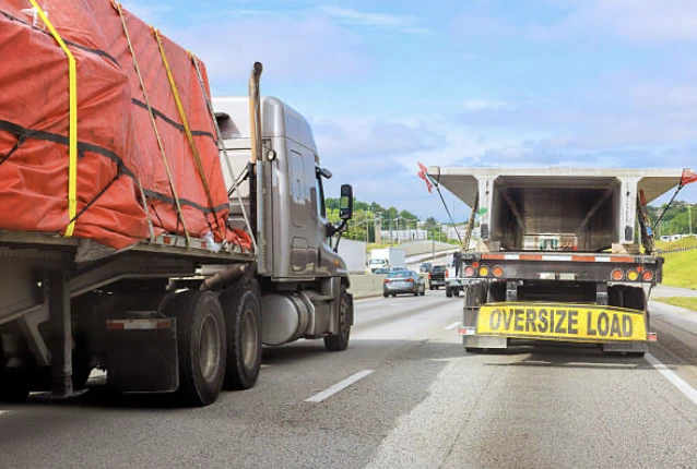
Permit-Aware Navigation

Defining the Concept: Permit-Aware Navigation

What “Permit-Based Routing” Means

Permit-based routing refers to the routing of a vehicle or load under a special permit (often because it is oversize, overweight or otherwise non-standard) in which the route itself is part of the permit. The permit may specify:

  • the origin and destination of the move

  • the approved route (or corridor) that may be used

  • vehicle dimensions (length, width, height), weight, axle configuration

  • time windows or travel restrictions (day/night, holiday, curfews)

  • escort, pilot car requirements

  • conditions for infrastructure (bridges, overhead wires, power lines)

  • allowable speed, lane usage, special signage

When routing must respect all those variables, you have permit-based routing.

What “Oversize Route Navigation” Means

Oversize route navigation is a subset of permit-based routing: focusing specifically on oversized or overweight loads. Such loads may have:

  • width above legal standard (e.g., more than 8.5 ft in US)

  • height above standard clearance

  • length beyond typical trailer limits

  • weight above standard GVW or axle limits


These impose infrastructure constraints (bridges, overhead wires, narrow or weak roads) and regulatory constraints (permits, special routes, escorts). So “oversize route navigation” emphasizes the navigation of those loads along compliant routes.

Why It Matters

From research and industry practice:

  • By relying on manual map routing, there is risk of infrastructure damage (bridge hits, overloaded roads) and violation of permit conditions. 

  • Best-practice permitting systems call out the need for automated routing modules that include geographical databases with detailed link information (clearances, weight limits) to support safe carrier routing. 

  • Oversize load route planning emphasizes the physical survey, identifying low-clearance infrastructure, narrow turning radii, and dynamic restrictions (construction zones, seasonal weight bans) as part of effective navigation. 

Thus, permit-aware navigation is not just “turn left here”, it is “turn left here because your height is 14 ft, the overhead clearance is 14.2 ft, the permit requires movement after 9 am, and the road under the bridge supports your axle weight”.

Core Components of Permit-Aware Navigation

Here are the typical components a system must have in order to perform permit-aware navigation effectively:

Load & Permit Data

  • Vehicle/load attributes: height, width, length, weight, axle configuration, overhangs

  • Permit specifics: approved route (or allowable route corridor), time window, travel restrictions, required escorts/pilot cars

  • Documented infrastructure constraints: bridges, underpasses, utility lines, posted height/weight limits

load and permit data

Geospatial Routing Data with Constraints

  • A map graph or network that includes metadata per road/link: e.g., vertical clearance, bridge weight limit, underpass width, turning radius, seasonal seasonal weight restrictions. For example, the FHWA best practices report states that a routing system should include these detailed link-level attributes. 

  • Dynamic updates: temporary work zones, construction closures, emergency restrictions. 

Routing Algorithm / Engine

  • A route search that takes as input the vehicle/load profile + permit constraints + network constraints

  • Computes a feasible route (not just shortest) that satisfies all constraints

  • Provides navigation instructions (turn-by-turn, or at least route guidance) that ensure the driver remains on the approved route

  • Monitors compliance: if the truck deviates, system may alert or re-route

  • Real-time navigation or tracking so the vehicle follows permit-route

  • Alerts for off-route or non-compliance

  • Post-trip reporting (for permit audit)

Integration & Compliance Features

  • Integration with permit offices / DOTs for route approval and updates

  • Audit logs and reporting for infrastructure protection and regulatory compliance

  • Interfaces for dispatchers and drivers with the correct constraints baked in

Example Workflow

  1. Carrier applies for permit → route is approved by DOT with defined corridor.

  2. Load data (dimensions, weight) is entered into the routing system.

  3. The system evaluates the map network with constraints and selects the permitted route.

  4. The driver uses navigation that is locked to the permitted route (or alerts if off route).

  5. During the trip, any dynamic restrictions (bridge closure, storm damage) feed into the system and may trigger re-routing or permit revision.

  6. After the trip, data logs show compliance with the permit route.

Key Benefits & Business Drivers

Why should logistics, heavy haul or transport operations care about permit-aware navigation? Here are some compelling business drivers:

  • Reduced risk of infrastructure damage: By avoiding unpermitted roads, low bridges or weak structures, carriers avoid fines, delays, liability. For instance, the FHWA report points to bridge hits often caused by deviations or missing restrictions. 

  • Permit compliance and fewer violations: Non-compliance can lead to large fines or permit revocations. Reading and following the permit route precisely is critical. 

  • Improved safety: Oversize loads are complex to manoeuvre; selecting roads with proper width, turning radius, clearance leads to safer moves.

  • Operational efficiency: Automating route selection and verifying constraints reduces manual work, survey time, re-routing and surprises. For example, modern route-planning articles emphasise using GIS tools and data to avoid surprises. 

  • Cost savings: Fewer delays, fewer fines, fewer manual plan changes translate into cost savings and improved margins.

  • Competitive differentiation: For carriers specialising in oversize / abnormal loads, offering guaranteed compliant routing can be a service differentiator.

Challenges & Implementation Considerations

While the benefits are significant, implementing permit-aware navigation is not trivial. Key challenges include:

Data Quality & Availability

  • A comprehensive network dataset with accurate clearances, weight limits, and turning radii is required. Many local roads lack such metadata.

  • Dynamic restrictions (construction zones, temporary bans) must be integrated timely. The FHWA report emphasises the importance of updates: “the system automatically updates route restrictions within approx. 15 minutes of receiving the information.” 

Integration with Permit Processes

  • Permits may be issued via state/local systems, and route approval may still be partly manual. Bridging between the routing engine and permit office is complex.

  • Changes to permit or route may require re-issuance; the system must support that. 

Vehicle & Load Variability

  • Every load may have different dimensions/axle configurations; the routing engine must support flexible profiles.

  • Overhangs, specialized trailers, and escort vehicles must be considered.

Monitoring & On-Route Control

  • Ensuring a driver stays on the approved corridor is critical; deviation can lead to penalties. The system needs monitoring, alerts and possibly locking into navigation mode. For example, an app described in one state required that the driver must be on the permit route in order for navigation to start working. 

Cost & Scalability

  • Generating custom routes, performing constraint checks, and supporting large volumes of permutations (especially for nationwide/ international loads) can be resource-intensive.

  • Scalability matters if business volume grows.

Schema FAQ Section

Here is a structured FAQ schema block that you could embed in an article or blog to support SEO for “what is permit-aware navigation”.

<script type=”application/ld+json”>

{

  “@context”: “https://schema.org”,

  “@type”: “FAQPage”,

  “mainEntity”: [

    {

      “@type”: “Question”,

      “name”: “What is permit-aware navigation?”,

      “acceptedAnswer”: {

        “@type”: “Answer”,

        “text”: “Permit-aware navigation is a routing and navigation system designed to guide vehicles – especially oversize or overweight loads – along a legally approved route that meets the conditions set out in the permit, by taking into account vehicle dimensions, road clearance, weight limits, and travel restrictions.”

      }

    },

    {

      “@type”: “Question”,

      “name”: “What is permit-based routing?”,

      “acceptedAnswer”: {

        “@type”: “Answer”,

        “text”: “Permit-based routing refers to generating and following a vehicle route that arises from an issued permit – the route is part of the permit, defined by the regulatory authority, and must be adhered to precisely.”

      }

    },

    {

      “@type”: “Question”,

      “name”: “Why is oversize route navigation important?”,

      “acceptedAnswer”: {

        “@type”: “Answer”,

        “text”: “Oversize route navigation is important because oversized and overweight loads face infrastructure constraints such as low bridges, narrow roads, weight-limited bridges, and require special permits and escort vehicles; proper navigation reduces risk, improves safety, and ensures legal compliance.”

      }

    },

    {

      “@type”: “Question”,

      “name”: “What key components are required for permit-aware navigation?”,

      “acceptedAnswer”: {

        “@type”: “Answer”,

        “text”: “Key components include: vehicle/load attribute data (dimensions, weight), permit data (approved route, travel window, restrictions), a geospatial network with clearance/weight metadata, a routing engine capable of constraint-based path search, navigation and monitoring tools, and integration with permit/regulatory systems.”

      }

    },

    {

      “@type”: “Question”,

      “name”: “What are common challenges when implementing permit-aware navigation?”,

      “acceptedAnswer”: {

        “@type”: “Answer”,

        “text”: “Common challenges include: obtaining accurate infrastructure and restriction data, integrating with permit-issuance processes, accommodating load variability, monitoring compliance in real time, scaling operations, and keeping dynamic restrictions (construction/closures) up to date.”

      }

    },

    {

      “@type”: “Question”,

      “name”: “How can technology platforms help with permit-aware navigation?”,

      “acceptedAnswer”: {

        “@type”: “Answer”,

        “text”: “Technology platforms can provide APIs and routing engines that support vehicle dimension constraints, specialized routing (truck/oversize), real-time traffic and infrastructure data, monitoring and alerts, route-compliance dashboards, and integration with ERPs or TMS – thereby automating much of the planning and execution.”

      }

    }

  ]

}

</script>

You can embed this JSON-LD in your website to support structured data and improve SEO visibility for permit-aware/permit-based routing topics.

How NextBillion.ai Supports Permit-Aware Navigation

Now that we’ve defined the concept and its requirements, let’s turn to how NextBillion.ai can help organisations implement permit-aware navigation.

Platform Capabilities Aligned to Permit-Aware Needs

Here are features of NextBillion.ai that map directly to the requirements of permit-based/oversize routing:

  • Customized vehicle mode with dimension/weight support: NextBillion.ai’s routing platform allows the specification of “truck” mode and allows you to define vehicle dimensions and constraints. 

  • Map editor / private routing preferences: With NextBillion.ai’s MapFusion and Road Editor you can impose your own turn restrictions, mark unsafe areas, define special roads, closures or private maps. This is essential for oversize routing where certain roads are off-limits. 

  • Advanced routing engine with many constraints: The platform advertises support for “50+ constraints” when optimizing routes. These constraints can include dimensions, load properties, time windows, etc.

  • Scalability for complex routing: Support for up to 10,000 stops or distance matrices of size 5,000 × 5,000 indicates heavy-duty capacity which is helpful when planning complex multi-haul oversize moves. 

  • Integration & APIs: It provides APIs for route optimization, directions, distance matrices, driver assignment, etc. That means you can integrate permit-aware routing into your dispatch/TMS system rather than building from scratch.

Use-Case: Oversize/Permit Routing with NextBillion.ai

Here’s how a transport operator could implement permit-aware navigation using NextBillion.ai:

1. Load & permit capture

  • Input vehicle/load attributes (height, width, length, weight) into system

  • Encode permit data: approved route, time window, allowed road types, restricted roads

order matching
Refer
here for API information.

2. Map & restriction configuration

  • Use NextBillion.ai’s map editor to flag roads that are not permitted for oversize loads (low clearance bridges, weak pavement roads, narrow lanes)

  • Ensure the base map contains metadata for clearance/weight/width or import such in the private road editor

  • Load dynamic restriction layers (construction zones, temporary closures) via MapFusion

3. Route generation

  • Use the Route Optimization or Directions API to compute a route from origin to destination, with constraints that ensure the load dimensions/weight are respected, time-window constraints met, and permit corridor respected


post request

Refer
here for API documentation on Directions API.

  • The solver respects “truck mode with size/weight constraints” and uses custom map data/modifiers

4. Navigation & monitoring

  • Deploy navigation (mobile/web SDK) or publish route to driver with turn-by-turn instructions

  • Monitor in real time that the vehicle stays on the permitted route; deviations trigger alerts

  • Post-trip, generate reports to show compliance with permit and route.

5. Updates & re-routing

  • If dynamic restriction arises (e.g., a bridge closes midday) you can update the road editor and re-generate the route, or prompt a permit amendment

  • The system can trigger when a previously-approved route becomes invalid due to new restrictions (mirroring what the FHWA report says about monitoring open permits when restrictions change). 

6. Integration with business systems

  • The routing engine ties into your TMS or ERP so dispatchers, load planners and drivers all operate from one system

  • Permitting departments (internal or external) can feed approved routes and restrictions into the platform rather than via disconnected spreadsheets.

Why NextBillion.ai is a Strong Choice

Given the requirements of permit-aware navigation and the capabilities just outlined, NextBillion.ai offers compelling strengths:
  • Constraint-rich routing engine – oversize routing requires more than standard routing; NextBillion.ai’s 50+ constraint capability matches this need.

  • Custom map data & editing – ability to add or edit roads, apply private restrictions means operators can maintain a “master safe map” for oversize loads.

  • Truck-aware routing – specifying vehicle dimensions and weight means the route suggestions won’t send a 15-ft high load under a 14-ft bridge.

  • Scalability and performance – large matrix capacity means even complex multi-haul or multi-state oversize planning is feasible.

  • Global and flexible map data – crucial for operators working in multiple jurisdictions or across countries, where local restrictions vary.

  • Integration scope – as many logistics operations already have TMS/ERP, the API-first approach means permit-aware navigation can be built into existing workflows rather than bolt-on.

  • Operational cost control – NextBillion.ai emphasises that its pricing is not per‐API-call (a common issue when many lookups are required) but in ways that support scaling without runaway cost.
last mile delivery

Putting It Together: A Strategic View for Logistics Teams

For logistics and transport teams specialising in oversize/abnormal loads (or considering doing so), here’s a strategic framework:

1. Audit current process

  • How do you currently plan oversize routes? Manual spreadsheets, map tools, old GPS?

  • How often are permit violations or infrastructure hits occurring?

  • What is the cost (delays, fines, equipment damage) when non-compliant routing happens

2. Define requirements

  • Vehicle/load types: what are your typical dimensions/weights?

  • Permits: which jurisdictions (states/countries) do you operate in, and what are their route and infrastructure constraints?

  • Routing requirements: must the vehicle remain exactly on the approved route? What happens if you deviate?

  • Change monitoring: how do you handle last-minute route closures or newly posted restrictions?

3. Select a technology platform

  • Choose one that supports constraint-based routing, truck/oversize profile, custom map editing, real-time monitoring, integration with your TMS.

  • Evaluate scalability (number of loads/day, matrix size) and cost model.

4. Build the workflow

  • Ingest load/permit data into routing system

  • Configure map with infrastructure constraints and private roads/closures

  • Generate route and deliver to driver; monitor compliance

  • Handle exceptions (route change, permit amendment)

  • Post-trip compliance auditing

5. Benefit Realisation

  • Measure KPIs: reduction in violations, fewer delays, improved safety, cost savings

  • Use data to continuously refine route-planning logic (machine learning or rules)

  • Leverage insights: which corridors cause most problems, where infrastructure constraints limit loads => business development or alternative routes.

6. Scale & Institutionalise

  • Build library of approved routes and load profiles for reuse

  • Automate permit integration and route-approval workflows

  • Consider multi-jurisdiction and multi-modal expansions

For this strategy, NextBillion.ai forms a solid technology foundation because it addresses multiple layers: mapping & network data, advanced routing algorithm, scalable infrastructure, integration readiness, and truck‐oversize support.

Conclusion

“Permit-aware navigation” (or “permit-based routing” / “oversize route navigation”) is an essential capability for companies transporting oversized or overweight loads. By embedding permit requirements, infrastructure constraints and vehicle/load specifications into the route planning and navigation process, carriers can reduce risk, ensure compliance, improve safety and optimise operations.

From the perspective of a logistics operations or technology manager, implementing such capability involves:

  • high-quality data (vehicle, load, infrastructure, permits)

  • a routing engine capable of enforcing constraints

  • map and navigation workflow that ensures the driver stays on authorised route

  • monitoring/adaptation when restrictions change

In this context, NextBillion.ai offers a platform that aligns very well with these needs: truck/oversize-capable routing, custom map editing, large-scale optimisation, API-first integration and global map data coverage.

If you are considering building or upgrading your oversize transport routing capability, you could adopt NextBillion.ai as the backbone of your “permit-aware navigation” system and then layer your business-specific permit logic, compliance workflows and dashboards. Its flexibility means you do not start from zero.

👉 So, without any delay book a demo with NextBillion.ai today and see how NextBillion.ai can help optimize your permit-aware oversize navigation.

About Author

Prabhavathi Madhusudan

Prabhavathi is a technical writer based in India. She has diverse experience in documentation, spanning more than 10 years with the ability to transform complex concepts into clear, concise, and user-friendly documentation.

Ready to get started?

Table of Contents