


Table of Contents
With an innovative route optimization engine, NextBillion.ai provides the most robust route planning APIs and SDKs in the industry. NextBillion.ai’s adaptable API building blocks can be tailored to fit a broad range of requirements, providing all-inclusive solutions for the field services, last-mile deliveries, on-demand services, and trucking industries.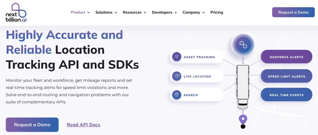
NextBillion.ai APIs and SDKs helps product and tech leaders in large-scale logistics companies address complex challenges such as multi-vehicle and multi-stop routing, scheduling, and navigation. They are particularly suited for Logistics and Transportation companies, Last-Mile delivery services, Trucking and Freight companies, Healthcare services, and many more.
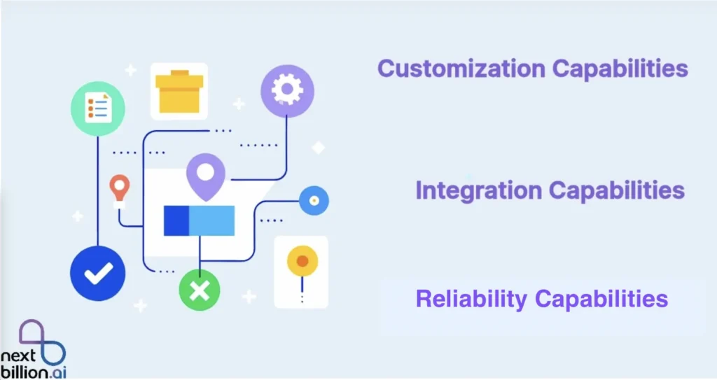
NextBillion.ai APIs and SDKs are ideal for any business to enhance their efficiency, scalability, and customer experience. Let’s dive into their unique features.
Maps Vector Tiles API – The NextBillion.ai Maps Vector Tiles API delivers vector tiles that include comprehensive vector data such as geometries, road names, and place names, represented as points, lines, and polygons. These tiles provide a rich source of geographic information that can be utilized for advanced map styling and creating interactive map experiences. By leveraging vector tiles, you can customize map visuals dynamically, integrate detailed data seamlessly, and enhance user engagement with highly interactive and responsive maps.
The following are some of its features:
Detailed Vector Data
Dynamic Styling
Scalable Performance
Layer Management
High-Resolution Rendering
Raster Tiles API – The NextBillion.ai Maps Raster Tiles API provides raster tiles from NextBillion.ai’s raster tilesets, delivering detailed pixel-based map imagery. Raster data is stored in a grid structure where each pixel has a uniform size and shape but varies in value. These raster tiles are essentially images that represent map data, which can be efficiently displayed as a grid of images on map-based tools and platforms. This format ensures consistent and high-resolution visual representation of maps, ideal for applications requiring static, high-quality map imagery.
The following are some of its features:
High-Resolution Imagery
Pixel-Based Data Format
Efficient Data Display
Consistent Visual Representation
Rapid Loading
Static Images API – The NextBillion.ai Static Images API provides standalone, static map images generated using NextBillion.ai’s custom styles. These images are designed for display on web and mobile devices, offering a straightforward way to incorporate map visuals into applications without the need for interactive mapping libraries or APIs. While the images resemble embedded maps, they do not include interactivity or controls, making them ideal for use cases where a simple, static map representation is sufficient.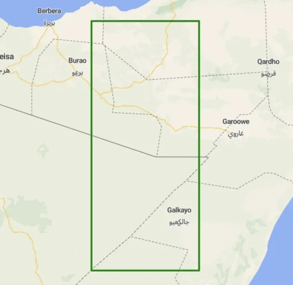
NextBillion.ai Android Maps SDK – It is a tool that allows you to integrate interactive maps seamlessly into your Android applications. With this SDK, you can enhance your apps by displaying dynamic maps, adding custom markers, drawing routes, implementing geolocation tracking and much more. By leveraging the Android Maps SDK, you can create visually appealing and feature-rich maps that enhance the user experience and provide valuable location-based services.
NextBillion.ai Flutter Maps SDK – It offers a feature-rich and user-friendly solution to integrate interactive maps, location-based services, and custom annotations effortlessly. Whether you are building a navigation app, a geospatial analysis tool or a location-based application, NextBillion.ai’s SDK provides a robust foundation to visualize and manipulate geospatial data with ease.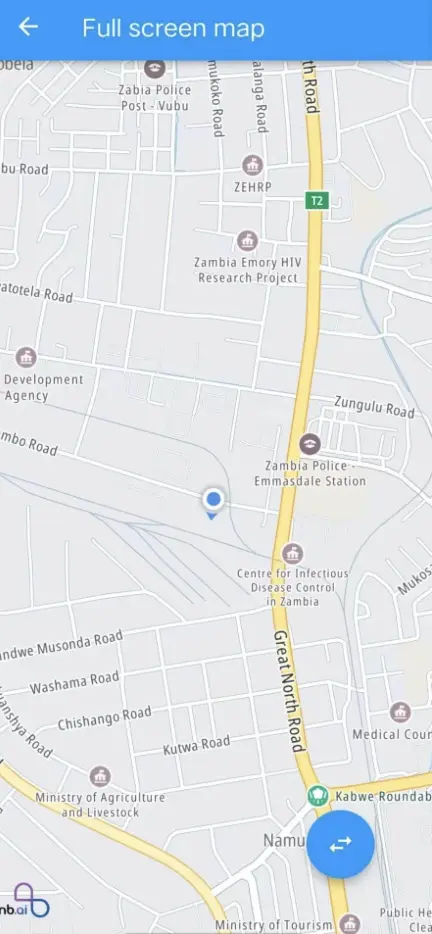
NextBillion.ai’s iOS Maps SDK – It empowers you as an iOS user with a comprehensive set of tools and capabilities to create immersive, feature-rich mapping experiences. With its accurate mapping data, advanced features, customization options and performance optimization, this SDK offers you the necessary resources to build innovative location-based applications that deliver exceptional value to their users.
Simple navigation with customizable branding and routing options. With mobile SDKs, you can quickly integrate into apps or use the Navigation API to create your own custom interface.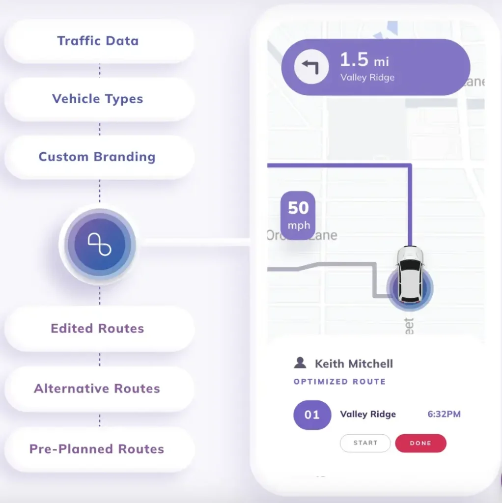
Comprehensive Map and Traffic Data – NextBillion.ai uses map and traffic data from multiple data providers. To provide guaranteed reliable routes and estimated times of arrival in your area(s) of operation.
Specialized Routes for Trucks – NextBillion.ai guarantees the safety of drivers, vehicles, and goods by using routes that comply with regulations and consider truck dimensions, cargo type, hazardous materials, and other essential factors.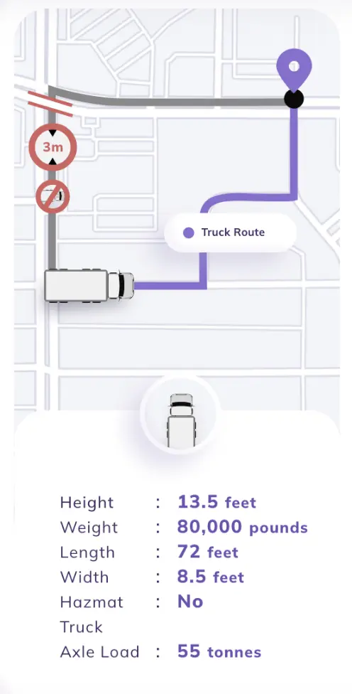
Off-Road Maps and Custom Routes – NextBillion.ai provides off-road navigation, private maps, and custom time-sensitive route restrictions such as road closures, speed limits and safety zones.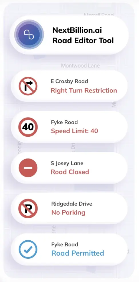
NextBillion.ai’s Road Editor App comes with a wide range of features that allow enterprises to achieve compliance with road safety and traffic regulations, as well as maximize asset utilization with reliable, customized, accurate routing. With the Road Editor app, NextBillion.ai helps you to overcome the challenges of facing last-minute changes in drop and pick locations, changes in traffic data, turn restrictions, no-parking zones, and so on. Geofencing is another significant feature offered by NextBillion.ai’s Road Editor App.
In this section, I’ll illustrate NextBillion.ai’s Geofencing feature. 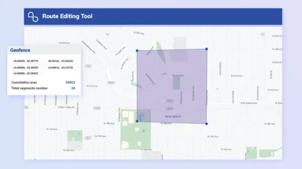
Using NextBillion.ai’s Geofencing feature, enterprises managing commercial vehicles can mark all the roads that are off-limits during specific hours as “closed.” NextBillion.ai’s Fleet customization feature will customize your requirement as per the restrictions.
NextBillion.ai offers a pricing model that reflects the value you receive, with flexible options to suit various needs. You can select from three product bundles tailored to different use cases and choose from three pricing units: per-order, per-asset, or per-API call. The cost per unit is based on your monthly usage volume and average order value, with lower per-unit costs as volume increases and order values decrease.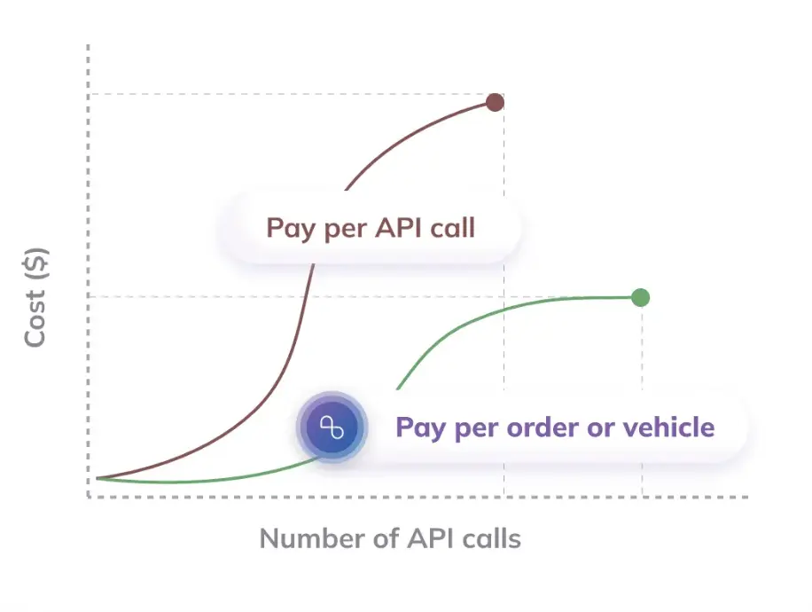
NextBillion.ai provides a single pricing edition with the option for a free trial, allowing you to explore the service before committing. Their flexible pricing plans cater to diverse business models, offering payment options based on assets, orders, or API calls.
A brief summary of the NextBillion.ai’s Pricing Plans are as follows:
Basic Route Planning – This plan mainly attracts enterprises with basic business needs and low complexity delivery.
You can get:
Advanced Route Planning – This plan aims at enterprises with complex multi-vehicle logistics needing advanced routing and technical support.
You can get:
Bespoke Route Planning – This plan targets high complexity and large-scale logistics requiring cross-border and customized routing.
You can get:
✅ Ease of Use: Despite its powerful customization options, NextBillion.ai has made significant strides in ensuring that its platform is user-friendly, making it easier for businesses to deploy and manage their mapping solutions.
✅ Route Optimization: NextBillion.ai excels in route optimization, making it an excellent choice for logistics and transportation businesses looking to enhance operational efficiency and reduce costs.
✅ Affordable Pricing: The platform provides competitive pricing, especially when compared to other major mapping providers. This can be particularly beneficial for businesses that need a powerful solution without breaking the bank.
✅ Scalability: Designed for large-scale operations, NextBillion.ai can handle high volumes of data and requests, making it suitable for growing businesses or those with extensive mapping needs.
❌ Limited Ecosystem: While the core features are strong, the ecosystem of third-party integrations, plugins, and extensions is not as mature as those of more established platforms.
❌ Performance Variability: Depending on the region and the complexity of the setup, there may be occasional performance issues, such as data accuracy or latency, particularly in less-developed areas.
The above information should have provided you with valuable insights into NextBillion.ai’s features and the benefits it can offer your business.
Google Maps APIs and SDKs are tools that allow you to integrate location-based services into their applications. These APIs offer a comprehensive suite of features, including interactive maps, geocoding, routing, and real-time data such as traffic and places of interest.
With Google Maps, you can create seamless user experiences, whether you’re building a mobile app for navigation, a web platform for location-based services, or a custom solution for your business needs. The SDKs support multiple platforms, including Android, iOS, and web, making it easy to bring your ideas to life across different devices.
Google Maps APIs and SDKs are designed for a wide variety of industries and use cases such as Automotive, Fleet Management, Retail and E-Commerce, Travel and Tourism, Business Intelligence and Analytics, Public Sector and Civic Planning, Consumer Applications, and so much more.
Google Maps operates on a pay-as-you-go pricing structure, meaning you only pay for the services you use. Charges depend on the number of requests for route calculations, including Directions, Distance Matrix, and Roads APIs. Google offers a monthly $200 free credit for all users. This credit can cover a significant amount of usage, especially for small applications. For businesses with high usage, Google offers volume discounts that reduce the per-request cost as your usage increases.
✅ Extensive Features: Google Maps offers a comprehensive set of APIs and SDKs that cover a wide range of functionalities.
✅ Global Coverage: Google Maps provides detailed and accurate maps for virtually every location worldwide, making it a reliable choice for businesses with global operations.
✅ Scalable: Whether you’re a small startup or a large enterprise, Google Maps scales well with your business needs, offering flexible pricing and enterprise-level solutions.
❌ Cost: While the $200 monthly credit is helpful, the costs can add up quickly, especially for high-traffic applications. For some businesses, this may become a significant expense.
❌ Data Privacy Concerns: Depending on the use case, some businesses might have concerns about data privacy, as using Google Maps APIs typically involves sharing data with Google.
Mapbox is the go-to live location platform for over 4 million developers worldwide. It offers global map data, real-time traffic updates, geocoding and address search, and routing and navigation services. Mapbox offers accurate location data and versatile developer tools, enabling businesses to integrate geospatial features into their applications and enhance their operations with advanced location intelligence.
Mapbox serves a diverse range of industries, including automotive, logistics, business intelligence, retail, travel, data visualization, consumer apps, weather, IoT, and geospatial analysis. Renowned for its high performance, customization options, reliability, and scalability, Mapbox’s location services are trusted by leaders across various sectors, from automotive and logistics to business intelligence and consumer applications.
Mapbox is designed to accommodate businesses of all sizes, offering a free tier to help you get started and generous free usage limits for most products. Its APIs and SDKs are priced based on monthly usage, without requiring upfront licenses or contracts. All accounts come with access to Mapbox Studio, a browser-based map styling and data management tool. Mapbox has 6 pricing editions for – Mapbox GL JS for web maps, Maps SDKs for Mobile, Navigation SDK, Mapbox Search, Other Mapbox APIs, Tileset hosting, and Data products, Mapbox Support plans.
✅ Versatile Thematic Mapping: Mapbox excels in creating maps with various themes and classifications, making it ideal for producing specialized maps, such as those used in architecture or other niche applications.
✅ Integration with OpenStreetMap: The ability to seamlessly integrate with the OpenStreetMap API enhances Mapbox’s functionality and provides additional flexibility for mapping projects.
✅ User-Friendly Map Styling: Mapbox Studio offers intuitive tools for styling maps, allowing you to easily customize and create visually appealing maps tailored to their specific needs.
❌ Confusing Pricing for Private Applications: The pricing structure for private applications can be unclear, making it challenging to understand costs and manage budgets effectively.
❌ Steep Learning Curve: Developers familiar with other APIs may find Mapbox’s learning curve to be steep, with a need to adapt to its unique features and tools.
HERE is the platform for map creation and location data services. HERE Platform’s suite of over 20 APIs and SDKs is designed for teams of all sizes, providing reliable data and user-friendly tools. Known for their reliability and extensive data coverage, HERE’s solutions offer comprehensive features that support a wide range of use cases, from navigation and routing to geocoding and real-time traffic updates.
HERE’s platform is built for flexibility, providing both freemium and premium offerings to fit different business requirements. HERE freemium offerings include capabilities for Geocoding and Search, Routing and Fleet Management, and Mapping. With HERE’s Data Layers, your team can access precise, detailed urban map data for civic, geological, and navigational purposes. These tools help enhance business visibility, optimize transportation, and improve client services.
Whether you are building applications for automotive, logistics, retail, or any other industry, HERE’s APIs and SDKs are designed to meet the needs of businesses of all sizes such as Automotive, Logistics, Retail, Travel, Data Visualization, Geospatial Analysis, and so on.
✅ High Data Accuracy: Known for its precise and reliable data, HERE ensures accurate location information, which is crucial for applications requiring detailed and dependable mapping.
✅ Effective Location Tracking: Provides solid location tracking capabilities, useful for applications that require real-time tracking and monitoring of assets or users.
✅ Freemium Option: HERE offers a freemium plan that allows you to start building and experimenting with basic features at no cost, making it accessible for initial development and testing.
❌ API Issues: Some users have reported issues with the APIs, such as inconsistent performance or difficulties in integration, which can affect the reliability and functionality of applications built with HERE Maps.
❌ Poor Usability: You may find the platform challenging to use, with complexities in implementing and managing features that could hinder the development process.
Bing Maps APIs and SDKs provide a comprehensive suite of tools designed to integrate advanced mapping and location services into your applications. Developed by Microsoft, Bing Maps offers high-quality map data, robust geocoding, routing, and location intelligence features that support a wide range of use cases.
With Bing Maps, you gain access to detailed and accurate global map data, real-time traffic updates, and powerful spatial analytics. The platform’s APIs and SDKs are designed to be flexible and scalable, making them suitable for businesses of all sizes and industries, from automotive and logistics to retail and real estate. Bing Maps provides a variety of features to enhance your applications, including customizable map styles, interactive visualizations, and detailed location information. Its integration with other Microsoft services and tools ensures a seamless experience for developers and users alike.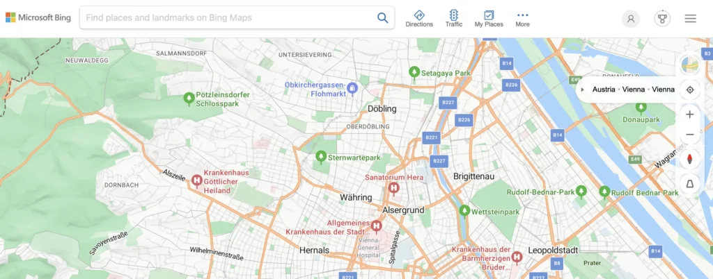
Bing Maps APIs and SDKs are designed for a diverse range of industries and applications, including Automotive, Retail, Real Estate, Travel, Business Intelligence, Consumer apps, Public sector, Healthcare, and so on.
Bing Maps V8 Web Control – It is the most recent Bing Maps JavaScript API. By integrating the AJAX map control with Bing Maps REST Services and Bing Spatial Data Services, you can build powerful websites and mobile applications featuring the latest imagery and advanced location functionality.
Comprehensive Bing Web Search API: Offers a powerful tool for accessing diverse search results from across the web, including websites, news, images, videos, and more, ensuring you receive a wide array of relevant information.
Bing Maps SDK for Android and iOS: Enables you to seamlessly incorporate a robust map control into their mobile applications, providing full-featured mapping capabilities.
Bing Spatial Data Services: Utilizes REST URLs to efficiently geocode and reverse-geocode large spatial datasets, as well as to create and query data sources. These data sources can store information about user-defined entities with spatial components. For instance, you can create a data source for a set of stores and then query it to locate stores near a specific location.
Bing Maps REST Services: Utilizes REST URLs to perform various tasks, including generating maps with pushpins, geocoding addresses, retrieving imagery metadata, and calculating routes.
✅ Accurate Results: The platform delivers reliable and precise mapping results, ensuring that you can trust the data and services provided by Bing Maps for various applications.
✅ Robust Search Functionality: Bing Maps offers powerful search capabilities, allowing users to efficiently find locations, businesses, and points of interest with accurate and relevant results.
✅ Fast Performance: Bing Maps is known for its speed, providing quick responses to API requests and ensuring smooth, responsive map interactions in applications.
❌ Poor UI Design: The user interface design of Bing Maps may not be as intuitive or modern, potentially affecting the ease of use and overall user experience in applications.
❌ High Costs: The pricing for Bing Maps can be relatively expensive, which may be a concern for projects with tight budgets or high usage requirements.

