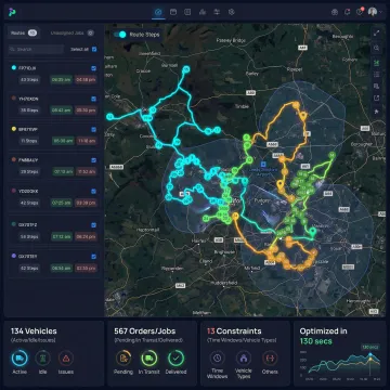
What is a geospatial API?
A geospatial API is a programmatic interface that lets applications access, process, and visualize location-based data, including mapping, routing, geocoding, distance calculation, geofencing, and real-time tracking. Logistics platforms, fleet management systems, navigation apps, and delivery tracking tools rely on geospatial APIs to translate raw geographic coordinates into operational decisions, such as which driver is nearest, whether a vehicle has entered a delivery zone, or the fastest compliant route for a given load.
What is the Geolocation API integration?
Geolocation API integration connects a software application to a geolocation service to determine the real-world position of a device, vehicle, or asset using GPS, Wi-Fi, or cell tower data. In logistics and fleet management, this integration powers live tracking, proximity-based dispatch, geofence event triggers, and route adherence monitoring, enabling automated workflows based on real-time driver and asset location. It typically runs alongside mapping and routing APIs so location data feeds directly into dispatch and ETA calculations rather than sitting in a separate system.
How does NextBillion.ai's geospatial API pricing work?
NextBillion.ai offers per-vehicle and per-order pricing models instead of the per-API-call pricing used by most mapping providers. This means high-frequency operations — including re-optimization cycles, batch planning runs, and demand spikes — don't translate into unpredictable cost overruns. Monthly costs align to your actual fleet size or order throughput, making budgeting straightforward and predictable.
Which geospatial APIs does NextBillion.ai offer?
NextBillion.ai offers a comprehensive suite including the Maps API, Distance Matrix API, Navigation API, Geofencing API, Live Tracking API, Snap-to-Road API, Route Reconstruction API, Isochrone API, Clustering API, Directions API, and Route Optimization API. These APIs work as standalone services or as an integrated platform covering the full lifecycle from planning through execution and post-trip analysis.
How long does geospatial API integration take?
Most NextBillion.ai API integrations go live within one week, including trial onboarding, data testing, and production deployment. Dedicated solutions engineers provide hands-on technical support throughout the process, reducing time-to-production compared with self-serve API onboarding. Timelines depend on how many APIs are being adopted and whether they connect to existing TMS, ERP, or telematics systems; more complex enterprise integrations are scoped individually during the onboarding call rather than following a fixed timeline.
Can NextBillion.ai APIs be deployed on-premise?
Yes. NextBillion.ai supports on-premise deployment via Kubernetes for organizations with data residency requirements, GDPR or CCPA compliance mandates, or private cloud infrastructure. The platform is also cloud-agnostic, with deployment options on AWS, Google Cloud, and Microsoft Azure. The full routing, navigation, tracking, and mapping stack can operate within your own infrastructure with no external data transmission.
Do the APIs support truck-specific and commercial vehicle routing?
Yes. The Distance Matrix, Navigation, and Directions APIs all support vehicle-specific routing for trucks and commercial fleets. Operators can specify vehicle dimensions — height, weight, axle load, length, and cargo type — to generate routes that comply with bridge restrictions, weight limits, low-clearance roads, hazardous material routing rules, and truck-prohibited streets. Car-routing assumptions are never applied to commercial vehicle calculations.
How does NextBillion.ai compare to Google Maps API?
NextBillion.ai is purpose-built for logistics and enterprise fleet operations where Google Maps is designed for consumer navigation. Key differences include: per-vehicle pricing versus per-call billing, Distance Matrix support up to 5,000×5,000 versus Google's 25×25 limit, truck-compliant routing with vehicle dimension constraints, custom road attribute editing through the Road Editor App, on-premise deployment, and 24/7 dedicated solutions engineering support — all unavailable on Google Maps Platform.
Is the Geolocation API free or paid?
NextBillion.ai's Geolocation and related location APIs are commercial, paid services priced on a per-vehicle or per-order basis rather than per API call. This differs from free-tier consumer geolocation tools, which typically cap usage volume and are not built for continuous fleet-scale tracking, geofence monitoring, or high-frequency location updates required in commercial logistics operations.
Is there a free GPS API available?
Some GPS and geolocation APIs offer limited free tiers, but these are generally built for low-volume consumer use, not commercial fleet tracking. Enterprise logistics operations require continuous location updates, geofencing, route adherence checks, and integration with dispatch systems at a scale free tiers are not designed to support, which is why NextBillion.ai offers paid, per-vehicle pricing instead of a free API tier.