Fleet technology is mainstream. Verizon Connect's 2025 fleet trends report surveyed 543 fleet professionals, and for five straight years at least four in five reported using at least one fleet technology. That is general adoption, not polygon adoption, but it shows the context.
The practical problem is familiar. A circle drawn around a depot often spills onto neighboring roads or properties while missing the yard or dock that matters. This guide explains how polygon geofencing works and when to use it.
Key Takeaways
- A polygon geofence is a closed boundary of connected coordinates that follows irregular sites.
- Software tests each location point against the shape to detect enter, exit, and dwell events.
- Alert quality depends on GPS quality, update frequency, map data, buffers, and dwell rules.
- Best fits: arrival detection, dock workflows, restricted zones, route compliance, and field-service automation.
What Is Polygon Geofencing?
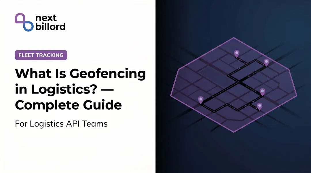
A polygon geofence is a virtual perimeter built by connecting latitude-and-longitude points into a closed shape. Software then checks whether a vehicle, device, person, or asset is inside that area.

Real sites are rarely round. A polygon can trace property lines, building footprints, access roads, yards, campuses, or a temporary work zone. Kestrel Insights notes that circles do not match irregular property lines, loading zones, or entry points.
What it is not
- Physical fence or barrier
- Routing engine
- GPS replacement
- Exact vehicle-position guarantee
It is a boundary-and-event layer that interprets location data. It turns raw pings into arrival, departure, dwell, unauthorized entry, or route deviation events.
Polygon, circle, or isochrone
| Boundary | Defined by | Best for |
|---|---|---|
| Circle | A point and a radius | Broad proximity alerts |
| Polygon | Ordered coordinates, optionally with excluded interior holes | Shape-specific sites and zones |
| Isochrone | Equal travel time or distance contour | Reachability and service coverage |
An isochrone answers "who can I reach in 30 minutes?" A polygon answers "is this truck inside the yard?" Different questions, different tools.
How Does Polygon Geofencing Work?
The process runs in five steps: define the boundary, receive location data, test it against the shape, apply event controls, and send the event to connected systems.

Initiation
An operator or developer picks ordered map coordinates around the area, then names it and assigns an asset group and alert rules. GeoJSON, the common exchange format, uses longitude-then-latitude order and requires a closed ring where the first and last positions match.
Monitoring depends on device permissions, GPS availability, telemetry intervals, map quality, timestamps, and a current polygon definition. Platforms set their own limits. Radar, for example, accepts 4 to 2,000 coordinates per polygon ring.
Core operation: the point-in-polygon test
For each incoming location, the system asks whether the point is inside or outside the shape. Many systems run a cheap bounding-box check first, then a precise test such as ray casting. Ray casting draws a line from the point and counts edge crossings: an odd count means inside.
Comparing the result with the previous state produces the event: enter, exit, or dwell. Edge behavior needs care too. PostGIS ST_Contains excludes points lying exactly on the boundary, while Turf.js offers an ignoreBoundary option.
Regulation and control
Raw GPS is noisy. Signal blockage and reflections off buildings cause drift, and a vehicle clipping a corner can trigger a false event. GPS.gov reports typical smartphone accuracy of 4.9 m (16 ft) under open sky, and worse near buildings, bridges, and trees.
Common controls:
- Accuracy filtering that ignores movement smaller than measured error
- Boundary buffers that delay entry or exit until a point is clearly past the edge
- Minimum dwell times before confirming arrival
- Debouncing so brief edge crossings don't flip state
Match controls to the workflow. A security zone may need an immediate exit alert. A delivery site may need a confirmed arrival after several minutes. Note that dwell timing depends on update cadence: Radar's dwell event fires on the first location report past the threshold, so sparse pings delay it.
Location data also carries privacy obligations. Set access controls and retention limits, and review applicable US rules. California treats precise geolocation as sensitive personal information, and employee exemptions under the CCPA expired December 31, 2022. Connecticut's amended monitoring law takes effect October 1, 2026. Check with counsel before tracking employees.
Output and result
Events go out as entry, exit, dwell, arrival, departure, or unauthorized-area signals. APIs, webhooks, and dashboards feed them to dispatch, TMS, telematics, CRM, inventory, customer notification, and reporting systems.
Good events produce trustworthy arrival records, fewer manual check-ins, better dwell analysis, and sharper customer updates. One example: Kestrel reports that EES, a fleet of over 300 vehicles, used polygon automation to generate over 10,000 geofences after a heavy manual workload. That shows scale, not a universal ROI figure.
Where Polygon Geofencing Is Used
Logistics and fleet
Facility polygons cover depots, warehouses, yards, customer properties, and docks. They trigger arrival notices, dock preparation, proof-of-presence records, dwell analysis, and security alerts.

Geotab's Zone Visits report, for instance, provides arrival time, visit duration, and departure time, and excludes pass-throughs without a stop.
Field service, last-mile, and NEMT
- Define service territories
- Confirm a technician reached the correct site
- Monitor approved corridors
- Automate job status changes
- Tell a real stop from driving past
Medical transport has a related need. New York's May 2024 Medicaid guidance requires trip start and end points plus GPS breadcrumbs, though that is electronic trip verification, not a polygon mandate.
When to use which boundary
- Polygon: site shape, access points, neighboring properties, multiple zones, corridors, or compliance boundaries matter
- Circle: a broad proximity alert is enough
- Isochrone: the question is travel time, not physical containment
Implementation tips and limits
- Start with high-value locations
- Use clear names and assign an owner
- Include access points without overcomplicating the shape
- Review sites that change, such as expanding yards
- Test edge cases like perimeter roads and parking lots
- Plan for GPS uncertainty, ping frequency, integrations, and alert volume
Teams building this into a broader location stack can evaluate NextBillion.ai. It offers customizable maps, route optimization, live tracking, and a Geofencing API, plus integrations for fleet platforms such as Geotab and Samsara.
Conclusion
Polygon geofencing converts a real-world area into a digital boundary, tests live or periodic location points against it, applies controls to cut unreliable events, and passes meaningful ones to operational systems.
Pick polygon, circular, or travel-time boundaries based on the business question. Then validate location quality, event rules, integrations, maintenance ownership, privacy practices, and measurable outcomes before scaling.
Frequently Asked Questions
What is the purpose of polygon geofencing?
It creates a boundary that follows an irregular real-world area and triggers operational events when an asset or device enters, exits, or stays within it.
Is polygon geofencing still relevant?
Yes. Major platforms including AWS, Geotab, and Radar still support polygons for logistics, fleet, field service, and compliance work. Circles and isochrones suit different questions.
How does polygon geofencing work?
Devices report locations, software tests each point against the polygon, event rules decide whether it counts as entry, exit, or dwell, and the event goes to connected systems.
What is the difference between polygon and circular geofencing?
A polygon is a custom multi-point boundary, while a circle is a center and radius. Use polygons for precise sites and circles for broad proximity.
How accurate is polygon geofencing?
Shape alone doesn't set accuracy. Signal conditions, device quality, update frequency, map data, buffers, and filtering rules all affect results.
What are common uses of polygon geofencing in logistics?
Facility arrival detection, loading-dock workflows, customer-site confirmation, restricted-area alerts, route-corridor monitoring, dwell analysis, and automated system updates.